Had another swim back out to the reef this lunch time, along with Howard the DD. I went out a few days ago too, and deliberately didn't take the camera to make sure it was a shorter trip. Needless to say, on that trip I saw lots of interesting things, but with no evidence, they're already fading in my memory.
But today's snorkel ...
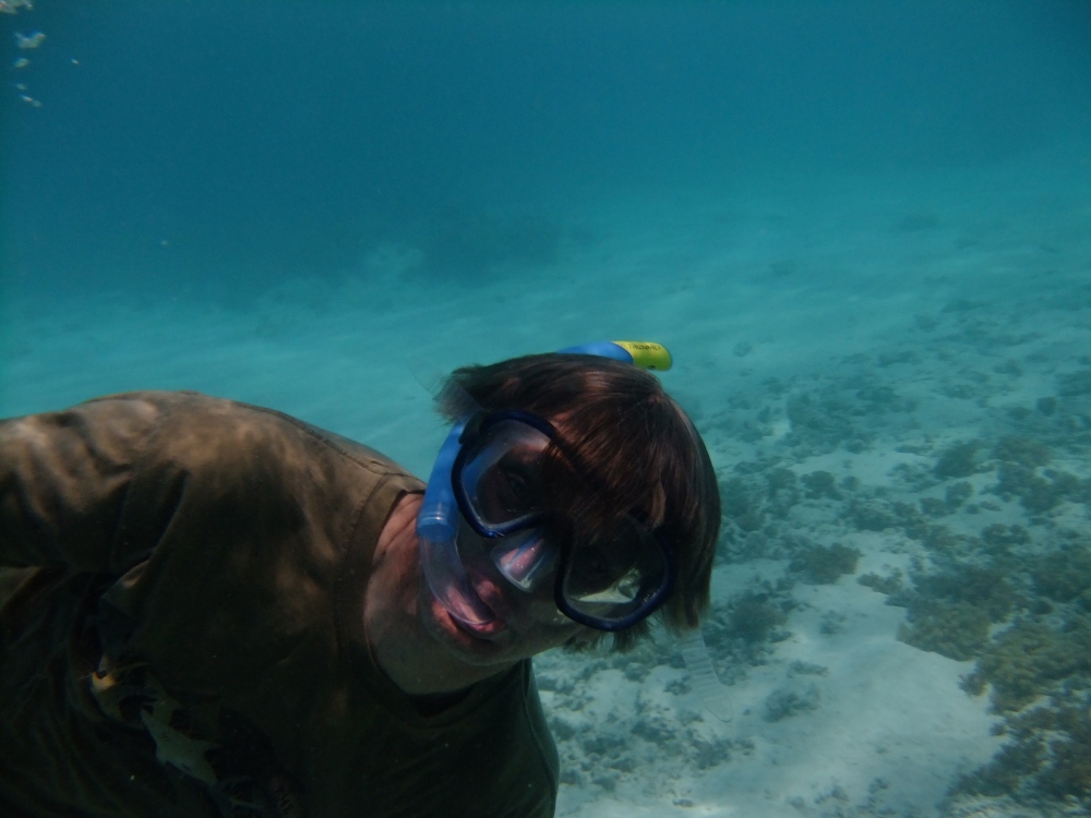
 Howard was having plenty of fun.
 Which is the purpose of the exercise.
Turtle shell
After much splashing around, and hunting for the reef break (where there is a line of coral heads at 4-5m, with a lot of life), we headed back towards shore.
I spotted this turtle carapace, laying on the seabed.
Last time I was here on Nyuni, I found parts of a turtle plastron (the front, dorsal or belly piece of the shell. And I'd found washed-up pieces of them on the beach too. So finding a carapace wasn't a great surprise.
After I'd taken a couple of photos of it as it lay on the seabed, interior with the ribs visible upwards, I was wondering if I'd have any hope of getting it back home. CITES, paperwork, difficult. And look at the size of it - that drag anchor for the goodie-bag is about 12cm long. I'm not getting that into my rig bag!
So, I got my photos first, then looked at the problem of "Can I carry this to shore without drowning?", as a necessary precursor to "Can I get this through customs?"
Then I turned it over. Surprise time!
 The shell started to delaminate. This dark outer covering came off as thin flexible sheets of a plastic-like material, with a layer of flesh (fatty?) bonding it onto the expanded ribs of the carapace (the bony shell).
I decided that I wasn't going to be able to carry this back to shore. The rest of the "get through customs" problem becomes a non-problem.
It's still there, if you want it. Though it's probably moved with each tide.
Next thing I spotted ... Can you see him? (Or, more likely, her?)

I saw it snaking across the seabed, then hiding behind this rock.
This is a crop from the main image above.

It's a Moray Eel, I think a White-eye Moray, but I'm not certain on that.
And for about the 4th time, Blogger's accursed post editor has lost 4 or 5 photos that I uploaded. And this is a really horrible, horrible editor.
But today's snorkel ...
 Howard was having plenty of fun.
 Which is the purpose of the exercise.
Turtle shell
After much splashing around, and hunting for the reef break (where there is a line of coral heads at 4-5m, with a lot of life), we headed back towards shore.
I
 spotted this turtle carapace, laying on the seabed.
Last time I was here on Nyuni, I found parts of a turtle plastron (the front, dorsal or belly piece of the shell. And I'd found washed-up pieces of them on the beach too. So finding a carapace wasn't a great surprise.
After I'd taken a couple of photos of it as it lay on the seabed, interior with the ribs visible upwards, I was wondering if I'd have any hope of getting it back home. CITES, paperwork, difficult. And look at the size of it - that drag anchor for the goodie-bag is about 12cm long. I'm not getting that into my rig bag!
So, I got my photos first, then looked at the problem of "Can I carry this to shore without drowning?", as a necessary precursor to "Can I get this through customs?"
Then I turned it over. Surprise time!
 The shell started to delaminate. This dark outer covering came off as thin flexible sheets of a plastic-like material, with a layer of flesh (fatty?) bonding it onto the expanded ribs of the carapace (the bony shell).
I decided that I wasn't going to be able to carry this back to shore. The rest of the "get through customs" problem becomes a non-problem.
It's still there, if you want it. Though it's probably moved with each tide.
Next thing I spotted ... Can you see him? (Or, more likely, her?)

I saw it snaking across the seabed, then hiding behind this rock.
This is a crop from the main image above.

It's a Moray Eel, I think a White-eye Moray, but I'm not certain on that.
And for about the 4th time, Blogger's accursed post editor has lost 4 or 5 photos that I uploaded. And this is a really horrible, horrible editor.

A different type of puffer fish.
Oh, sorry, Blogger has lost the original picture of a different species of puffer fish.
 And finally the bloody anenomefish that inspired the title of this post. Unfortunately the pictures have got so screwed up and I don't have time to struggle with this pathetic editor any more.


